
|
Welcome to the:
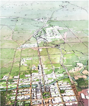
Mid-Michigan Mapping and Impact Assessment Toolkit Supporting Community Environmental, Social, Economic, and Health Impact Assessment and Planning A Project of The Mid-Michigan Health In All Program, The Mid-Michigan Program for Greater Sustainability, Tri-County Regional Planning Commission, and Michigan State University |
|
|

|
HEALTH IMPACT ASSESSMENT: Good Planning and Decision Making to Promote Healthy Communities and Lifestyles
While decision makers in public and private sectors often have direct or indirect impact on individual and community health, health considerations are not commonly included in the planning and decision making process. Health Impact Assessment (HIA) is a tool that can be offered to decision makers to elevate health considerations in various planning boards.
Health Impact Assessment is defined as a combination of procedures, methods, and tools by which a policy, program, or project may be judged as to its potential effects on the health of a population, and the distribution of those effects within the population. HIA identifies appropriate actions to manage those effects.
The HIA Toolkit helps support the HIA process by providing free access to environmental and health data to planners, decision makers, landowners, developers, and the public; mapping and visualization applications; and assessment of impacts that will showcase how to integrate an assessment of public health impacts within a greater, dynamic movement towards sustainability in our region.
For more information, explore the Menu bar, review completed HIAs, search for HIA resources, and try the on-line GIS Mapping Tool to assess a project in your community.
News
April 3, 2015. We have completed two HIAs in the Mid-Michigan Region - one on the Fair and Affordable Housing Plan and one on the Urban and Rural Service Management Policy. Project reports, supporting materials, and how-to resources can be found in the Projects and HIA Practices in the Menu bar. The Final HIA Reports were published in early Summer 2015 and are available to the public on the Ingham County website.
February 5, 2015. The data mapping and impact assessment feature of the HIA Toolkit now provides hyperlinks to the recently completed Corridor Design Portfolio. Designed by the Land Policy Institute at Michigan State University as part of the Mid-Michigan Program for Greater Sustainability, the Portfolio is a highly visual, educational tool for citizens, neighborhood leaders, developers, and local officials in the mid-Michigan region. The Portfolio features sustainability needs in the areas of Livability, Governance, Environment, Community, and Economy. Users of the HIA Toolkit’s Assess a Local Project tool will find links to successful planning and design practices from local communities, other websites, and online resources. The full-color version of the Portfolio is available for download online at: www.landpolicy.msu.edu.
Citation: Madill, H., J. Keesler, J. Cox, P. Toor, and M.A. Wycoff (2014). Building Livable Communities: Corridor Design Portfolio. (http://www.landpolicy.msu.edu/modules.php?name=Pages&sp_id=705). Land Policy Institute: Planning & Zoning Center, Michigan State University, East Lansing, MI.

|
|

|

|
Last Modified: May 12, 2016
